
The transition is often so gradual that it escapes the notice of those on the ground, but from hundreds of miles above the Earth’s surface, the transformation of the American landscape is undeniable. In a series of striking satellite images captured over the last decade, the quiet, rural corners of the United States are being fundamentally reshaped by the physical demands of the artificial intelligence revolution. These images, which document the metamorphosis of forests and fields into massive industrial complexes, offer a rare and sobering look at the infrastructure required to power the digital world.
For years, the concept of "the cloud" has been marketed as something ethereal—a weightless, invisible repository for the world’s data. However, as the demand for generative AI and frontier large language models explodes, the physical reality of that cloud is becoming increasingly grounded in concrete, steel, and silicon. The latest time-lapse photography, shared by Benjamin Grant of the popular Daily Overview project, highlights the sheer scale of this expansion, focusing on some of the largest data center build-outs currently underway in the United States.
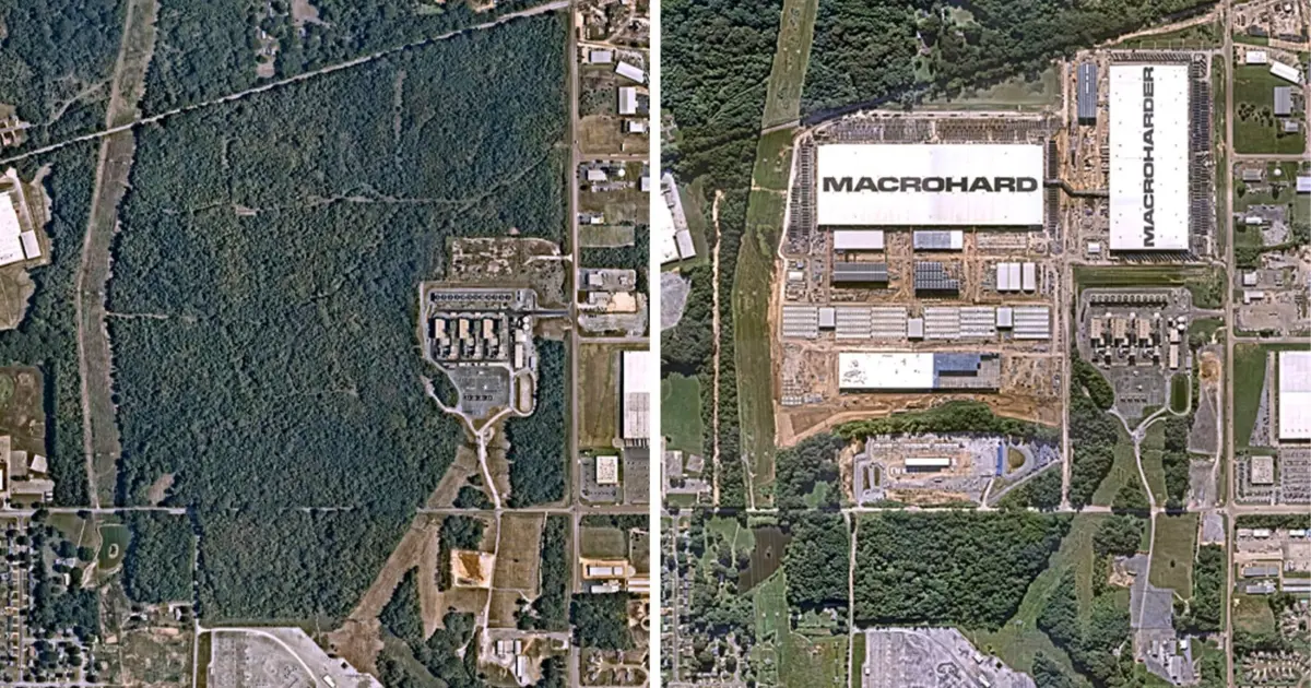
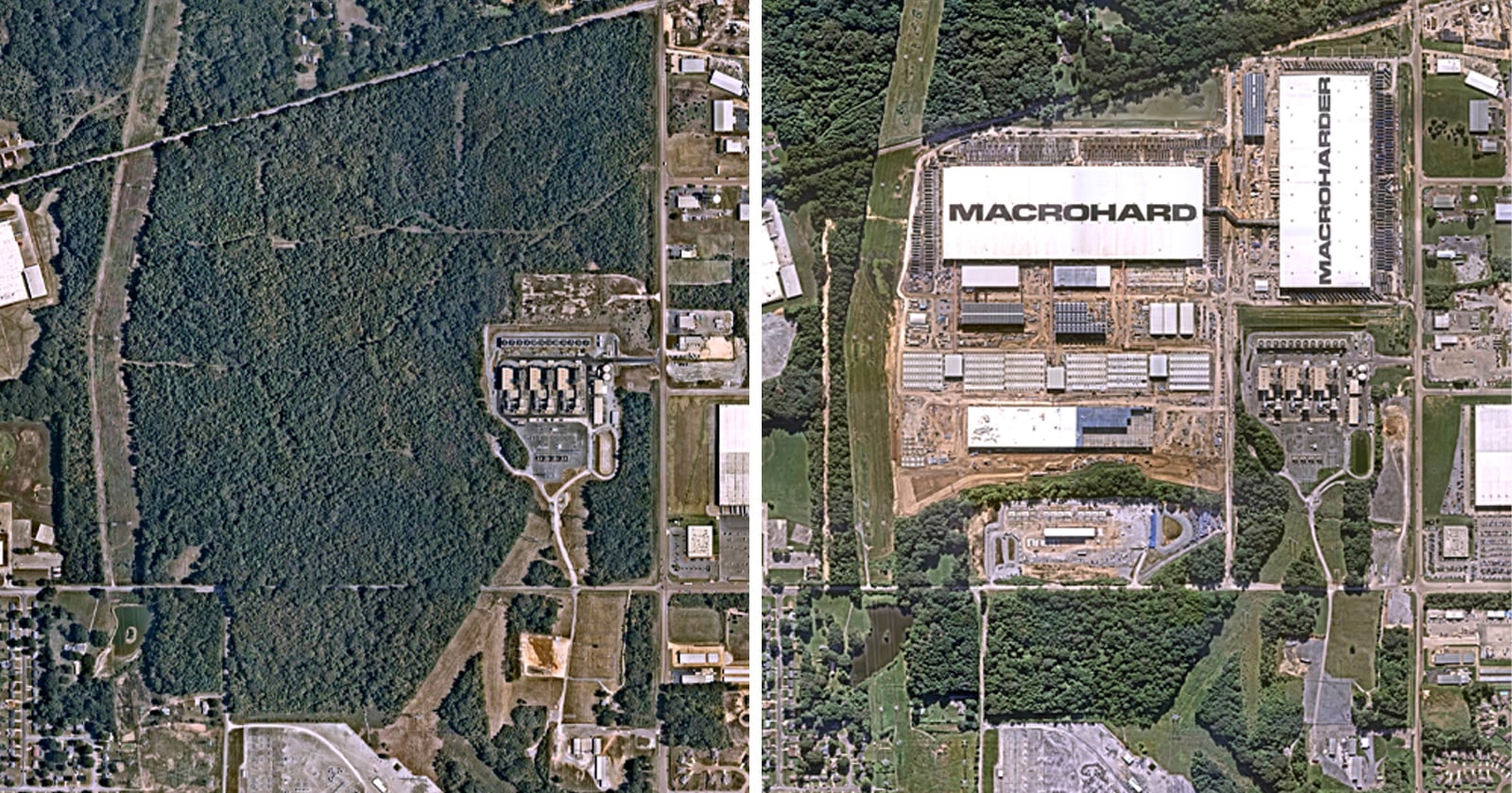
One of the most dramatic comparisons features an xAI site in Memphis, Tennessee. In the span of roughly a decade, between 2015 and 2026, a dense canopy of green has been systematically replaced by the sharp, grey geometry of industrial architecture. Large-scale buildings, some labeled with names like "MACROHARD," now dominate a landscape that was once defined by its natural foliage. The side-by-side aerial views serve as a visual testament to the speed at which the AI industry is moving, often outpacing the public’s ability to process the environmental and social implications of such rapid growth.
Benjamin Grant, who has spent years curated satellite imagery to provide perspective on how humans are changing the planet, explains that the timing for this specific project felt necessary. With AI dominating global headlines for several years, Grant sought to capture the physical manifestation of this technological boom. He noted that while the digital outputs of these companies are discussed incessantly, the physical infrastructure—the massive "campuses" that house the servers—often remains hidden from public view.
The scale of these projects is difficult to comprehend without the "overview effect" provided by satellite photography. In Huntsville, Alabama, an aerial view of what was once a quiet patchwork of agricultural fields and small residential subdivisions has been interrupted by the sprawling footprint of a Meta data center. Similarly, in Abilene, Texas, the rural landscape—once characterized by dirt roads, scattered vegetation, and small ponds—is now centered around a massive industrial facility designed to support OpenAI’s growing computational needs.